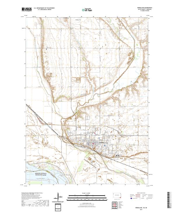
2021 Map of Vermillion
USGS Topo · Published 2021About this map
Vermillion serves as the focal point of this Clay County landscape, where the academic grounds of the University of South Dakota and the Clay County Courthouse define the city's modern layout. The terrain is characterized by the convergence of the Vermillion River and the Missouri River, the latter designated here as the Missouri National Recreation River. This hydrographic network, which includes the Clay Cr Ditch and Spirit Mound Creek, shaped the region's agricultural development and early settlement patterns along the South Dakota and Nebraska border.
Find a feature on this map
39 named features on this map. Tap any name to fly to it.
Don’t see what you’re looking for? This feature index may not catch every label — zoom into the map to look around manually.
Map Details
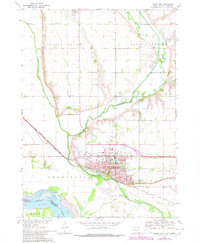
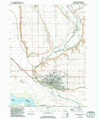
Editions of this 2021 Vermillion Map
This is the sole edition of this map. No revisions or reprints were ever made.
Historical Maps of Vermillion Through Time
3 maps found
Featured Locations
- Vermillion Township, SD
- Prairie Center Township, SD
- Spirit Mound Township, SD
- Hooker Township, NE
- Vermillion, Vermillion Township