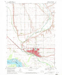
1969 Map of Vermillion
USGS Topo · Published 1971About this map
The University of South Dakota dominates the cultural and physical landscape of Vermillion in this late 1960s survey, showing a campus defined by streets like University St and Harvard St. The city is positioned on a bluff north of the Vermillion River and its confluence with the Missouri River at the South Dakota-Nebraska border. This riverine geography is reflected in the drainage systems like the Clay Creek Ditch, which cuts across the fertile floodplains south of the Spirit Mound landmark. The mapping details the transition from an urban university center to a rural agricultural hinterland, marked by country schoolhouses such as Prairie Bell Sch and Center Point Sch. The presence of the Chicago Milwaukee St Paul and Pacific railroad line suggests the historical reliance on rail for transporting goods from the surrounding farms and gravel pits.
Find a feature on this map
47 named features on this map. Tap any name to fly to it.
Don’t see what you’re looking for? This feature index may not catch every label — zoom into the map to look around manually.
Map Details
Editions of this 1969 Vermillion Map
2 editions found
Other maps of this area

1898 · Elk Point
USGS Topo · 1:125,000

1901 · Elk Point
USGS Topo · 1:125,000

1907 · Elk Point
USGS Topo · 1:125,000

1955 · Sioux City
USGS Topo · 1:250,000

1958 · Sioux City
USGS Topo · 1:250,000

1959 · Sioux City
USGS Topo · 1:250,000

1964 · Burbank
USGS Topo · 1:24,000

1964 · Maskell
USGS Topo · 1:24,000

1968 · Obert
USGS Topo · 1:24,000
1968 · Meckling
USGS Topo · 1:24,000
Featured Places
- Vermillion, SD
- Vermillion Township, SD
- Spirit Mound Township, SD
- Fairview Township, SD
- Hooker Township, NE