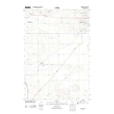
2013 Map of Vermillion
USGS Topo · Published 2013About this map
Vermillion River meanders across the landscape south of Hastings, carving a distinct path through the glacial terrain of Dakota County. The small community of Vermillion sits at a crossroads where Main St E and Northfield Blvd meet, anchored by the local Po and the nearby Saint John's Catholic Cem. This 2013 digital survey illustrates the area's transition from the dense residential grid of southern Hastings to the wide-open acreage of Rosemount and the surrounding townships. Large-scale recreation is represented by the Emerald Greens Golf Course, while several historic burying grounds, including Oakwood Cem and Lyon Cem, provide points of interest for genealogists tracing family roots in this corner of Minnesota.
Find a feature on this map
41 named features on this map. Tap any name to fly to it.
Don’t see what you’re looking for? This feature index may not catch every label — zoom into the map to look around manually.
Map Details
Editions of this 2013 Vermillion Map
This is the sole edition of this map. No revisions or reprints were ever made.
Other maps of this area

1896 · St. Paul
USGS Topo · 1:62,500

1946 · Hudson
USGS Topo · 1:62,500

1949 · Hudson
USGS Topo · 1:62,500

1950 · St Paul Park
USGS Topo · 1:24,000

1951 · St Paul Park
USGS Topo · 1:24,000

1951 · Prescott
USGS Topo · 1:24,000

1951 · Inver Grove
USGS Topo · 1:24,000

1951 · St. Paul
USGS Topo · 1:62,500

1953 · Saint Paul
USGS Topo · 1:250,000

1957 · Farmington
USGS Topo · 1:62,500