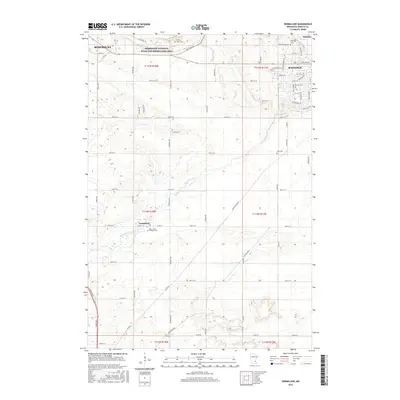
2016 Map of Vermillion
USGS Topo · Published 2016About this map
The Vermillion River meanders eastward across this Dakota County landscape, linking the rural town of Vermillion with the southern reaches of Hastings and the edge of Rosemount. In the north, the protected lands of the Mississippi National River and Recreation Area, also noted by the acronym Mnrra, mark the transition toward the river valley. The map is a significant resource for genealogists, as it identifies several local burial sites including Spring Lake Cem, Oakwood Cem, and Lyon Cem, along with Saint John's Catholic Cem located south of the main village. The terrain is defined by a network of established county roads like Co Rd 42 and Co Rd 47, alongside local routes such as Pine Bend Trl and Fischer Ave, illustrating the agricultural and suburban patterns in this portion of the Twin Cities metropolitan periphery.
Find a feature on this map
58 named features on this map. Tap any name to fly to it.
Don’t see what you’re looking for? This feature index may not catch every label — zoom into the map to look around manually.
Map Details
Editions of this 2016 Vermillion Map
This is the sole edition of this map. No revisions or reprints were ever made.
Other maps of this area

1896 · St. Paul
USGS Topo · 1:62,500

1946 · Hudson
USGS Topo · 1:62,500

1949 · Hudson
USGS Topo · 1:62,500

1950 · St Paul Park
USGS Topo · 1:24,000

1951 · St Paul Park
USGS Topo · 1:24,000

1951 · Prescott
USGS Topo · 1:24,000

1951 · Inver Grove
USGS Topo · 1:24,000

1951 · St. Paul
USGS Topo · 1:62,500

1953 · Saint Paul
USGS Topo · 1:250,000

1957 · Farmington
USGS Topo · 1:62,500