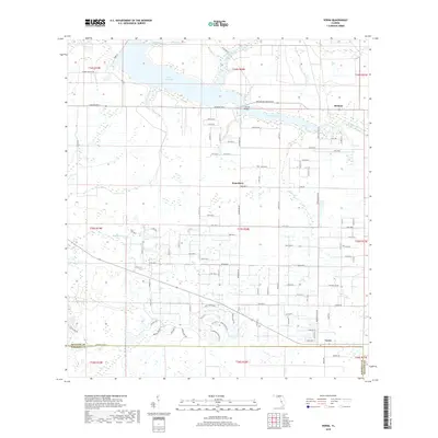
2018 Map of Verna
USGS Topo · Published 2018About this map
Lake Manatee dominates the northern reaches of this Florida landscape, a central reservoir fed by Boggy Creek and Gilley Creek. The area transitions from the open waters and marshy edges of the lake down toward the winding course of the Manatee River, where Sullivan Bridge carries Manatee Ave E across the channel. This late-2010s survey captures a mix of rural community centers and expanding residential grids, with the small settlements of Bethany, Waterbury, and Verna serving as local anchors.
Find a feature on this map
28 named features on this map. Tap any name to fly to it.
Don’t see what you’re looking for? This feature index may not catch every label — zoom into the map to look around manually.
Map Details
Editions of this 2018 Verna Map
This is the sole edition of this map. No revisions or reprints were ever made.
Other maps of this area

1944 · Rye
USGS Topo · 1:31,680

1944 · Verna
USGS Topo · 1:31,680

1944 · Lorraine
USGS Topo · 1:31,680

1944 · Parish
USGS Topo · 1:31,680

1944 · Miakka
USGS Topo · 1:31,680

1947 · Bee Ridge
USGS Topo · 1:24,000

1956 · Myakka City
USGS Topo · 1:24,000

1956 · Myakka City NW
USGS Topo · 1:24,000

1956 · Keentown
USGS Topo · 1:24,000

1956 · Tampa
USGS Topo · 1:250,000