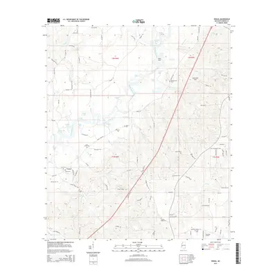
2015 Map of Vernal
USGS Topo · Published 2015About this map
The Chickasawhay River dominates this Greene County landscape, winding south through a series of sharp meanders and riverine features like Byrd Bend, Foshee Eddy, and Green Eddy. The river's influence is evident in the numerous oxbow lakes and branches that dot its course, including Muddy Lake, Horseshoe Lake, and Ashley Lake. The small settlement of Vernal serves as a focal point in the southwestern quadrant, surrounded by legacy family landmarks and several burial grounds that provide significant genealogical value for the area.
Find a feature on this map
116 named features on this map. Tap any name to fly to it.
Don’t see what you’re looking for? This feature index may not catch every label — zoom into the map to look around manually.
Map Details
Editions of this 2015 Vernal Map
This is the sole edition of this map. No revisions or reprints were ever made.
Other maps of this area

1941 · Lucedale
USGS Topo · 1:62,500

1942 · Deer Park
USGS Topo · 1:62,500

1942 · Wilmer
USGS Topo · 1:62,500

1943 · Lucedale
USGS Topo · 1:62,500

1943 · Deer Park
USGS Topo · 1:62,500

1944 · Wilmer
USGS Topo · 1:62,500

1953 · Hattiesburg
USGS Topo · 1:250,000

1953 · Mobile
USGS Topo · 1:250,000

1957 · Mobile
USGS Topo · 1:250,000

1958 · Hattiesburg
USGS Topo · 1:250,000