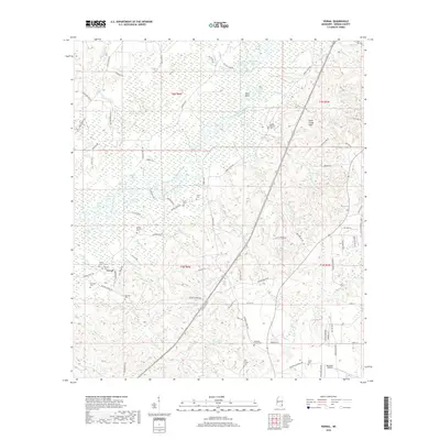
2018 Map of Vernal
USGS Topo · Published 2018About this map
The Chickasawhay River winds through a landscape defined by its wetlands and riverine geography, carving through sections like Byrd Bend and Big Eddy. This Greene County corridor is characterized by a high concentration of oxbow lakes and marshes, including Muddy Lake, Horseshoe Lake, and Fence Lake. The settlement patterns here are deeply tied to the land, with numerous family and community cemeteries such as McInnis Cem, McIntosh Cem, and Maple-McLeod Cem scattered across the rural landscape.
Find a feature on this map
104 named features on this map. Tap any name to fly to it.
Don’t see what you’re looking for? This feature index may not catch every label — zoom into the map to look around manually.
Map Details
Editions of this 2018 Vernal Map
This is the sole edition of this map. No revisions or reprints were ever made.
Other maps of this area

1941 · Lucedale
USGS Topo · 1:62,500

1942 · Deer Park
USGS Topo · 1:62,500

1942 · Wilmer
USGS Topo · 1:62,500

1943 · Lucedale
USGS Topo · 1:62,500

1943 · Deer Park
USGS Topo · 1:62,500

1944 · Wilmer
USGS Topo · 1:62,500

1953 · Hattiesburg
USGS Topo · 1:250,000

1953 · Mobile
USGS Topo · 1:250,000

1957 · Mobile
USGS Topo · 1:250,000

1958 · Hattiesburg
USGS Topo · 1:250,000