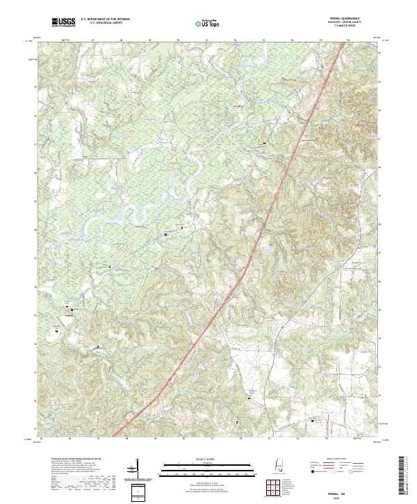
2024 Map of Vernal
USGS Topo · Published 2024About this map
The Chickasawhay River dominates this Greene County landscape, winding through a complex system of backwaters including Muddy Lake, Horseshoe Lake, and Log Lake. The river's influence is evident in the numerous eddies and oxbows, such as Green Eddy and Byrd Bend, which define the low-lying eastern portion of the quadrangle. In contrast, the Sand Creek Hills rise to the northeast, marking a shift in the local topography away from the river's alluvial plain.
Find a feature on this map
100 named features on this map. Tap any name to fly to it.
Don’t see what you’re looking for? This feature index may not catch every label — zoom into the map to look around manually.
Map Details
Editions of this 2024 Vernal Map
This is the sole edition of this map. No revisions or reprints were ever made.
Other maps of this area

1941 · Lucedale
USGS Topo · 1:62,500

1942 · Deer Park
USGS Topo · 1:62,500

1942 · Wilmer
USGS Topo · 1:62,500

1943 · Lucedale
USGS Topo · 1:62,500

1943 · Deer Park
USGS Topo · 1:62,500

1944 · Wilmer
USGS Topo · 1:62,500

1953 · Hattiesburg
USGS Topo · 1:250,000

1953 · Mobile
USGS Topo · 1:250,000

1957 · Mobile
USGS Topo · 1:250,000

1958 · Hattiesburg
USGS Topo · 1:250,000