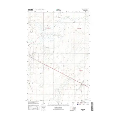
2016 Map of Verndale
USGS Topo · Published 2016About this map
The Leaf River and Wing River meander through this portion of central Minnesota, defining a landscape of agricultural tracts and wetland pockets between the communities of Wadena and Verndale. The settlement pattern is anchored by the township and range grid, where rural roads like Leaf River Rd and Ash Ave Ne connect outlying farms to the local centers. Genealogists will find significant local history preserved at Leaf River Cem in the northwest, as well as Saint Fredericks Cem and Greenlawn Cem located near the Verndale townsite. The terrain is marked by the slow-moving waters of Union Cr, which cuts across the western fields, illustrating the drainage patterns that have influenced land use and development in Wadena County into the twenty-first century.
Find a feature on this map
43 named features on this map. Tap any name to fly to it.
Don’t see what you’re looking for? This feature index may not catch every label — zoom into the map to look around manually.
Map Details
Editions of this 2016 Verndale Map
This is the sole edition of this map. No revisions or reprints were ever made.
Other maps of this area

1953 · Brainerd
USGS Topo · 1:250,000

1957 · Brainerd
USGS Topo · 1:250,000

1958 · Brainerd
USGS Topo · 1:250,000

1965 · Brainerd
USGS Topo · 1:250,000

1966 · Aldrich North
USGS Topo · 1:24,000

1966 · Aldrich South
USGS Topo · 1:24,000

1969 · Sebeka SW
USGS Topo · 1:24,000

1969 · Bertha
USGS Topo · 1:24,000

1969 · Wrightstown
USGS Topo · 1:24,000

1969 · Wadena
USGS Topo · 1:24,000