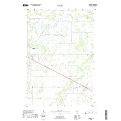
2019 Map of Verndale
USGS Topo · Published 2019About this map
Wadena and Verndale anchor this corner of Wadena County, where the agricultural landscape is shaped by the winding paths of the Leaf River, Wing River, and Union Cr. The survey illustrates a meticulous grid of rural routes such as Leaf River Rd and Dink Joint Rd, interspersed with local landmarks that serve as vital records for family historians. These include Leaf River Cem, Saint Frederick's Cem, and Greenlawn Cem, which are situated along the primary transportation corridors. The terrain is notably influenced by the hydraulic network, with numerous wetlands and small water bodies flanking the river systems. This 2019 edition captures the modern distribution of homesteads and farm infrastructure, providing a clear view of the township divisions between T135N and T134N.
Find a feature on this map
57 named features on this map. Tap any name to fly to it.
Don’t see what you’re looking for? This feature index may not catch every label — zoom into the map to look around manually.
Map Details
Editions of this 2019 Verndale Map
This is the sole edition of this map. No revisions or reprints were ever made.
Other maps of this area

1953 · Brainerd
USGS Topo · 1:250,000

1957 · Brainerd
USGS Topo · 1:250,000

1958 · Brainerd
USGS Topo · 1:250,000

1965 · Brainerd
USGS Topo · 1:250,000

1966 · Aldrich North
USGS Topo · 1:24,000

1966 · Aldrich South
USGS Topo · 1:24,000

1969 · Sebeka SW
USGS Topo · 1:24,000

1969 · Bertha
USGS Topo · 1:24,000

1969 · Wrightstown
USGS Topo · 1:24,000

1969 · Wadena
USGS Topo · 1:24,000