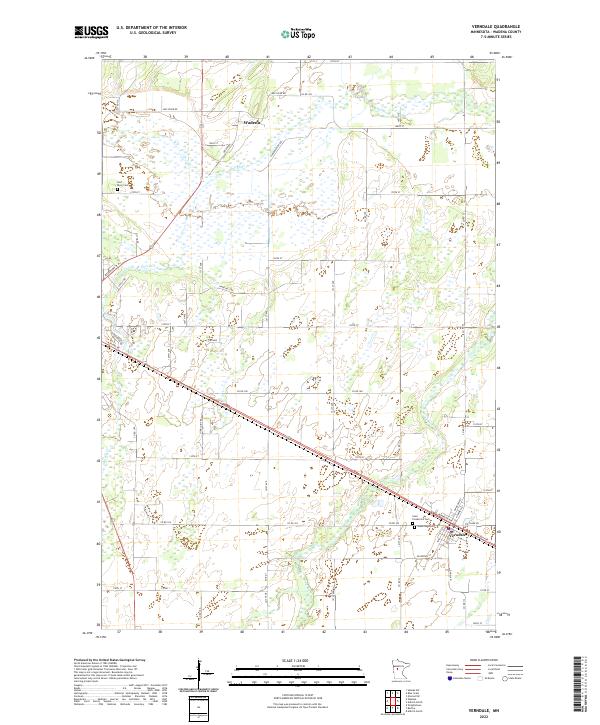
2022 Map of Verndale
USGS Topo · Published 2022About this map
Verndale and the southeastern outskirts of Wadena anchor this Central Minnesota landscape, where the prairie begins to meet the wooded river bottoms. The area is defined by the winding paths of the Leaf River, Wing River, and Union Creek, which cut through a grid of rural section roads and family-named routes like Harry-Rich Drive and the curiously named Oink Joint Road. Historically significant sites for genealogists include Saint Frederick's Cemetery and Greenlawn Cemetery situated near the Verndale townsite, along with the Leaf River Cemetery to the northwest. The terrain reveals a transition from intensive agriculture to wetter lowlands, punctuated by numerous small wetlands and drainage patterns that have shaped the development of Wadena County for over a century.
Find a feature on this map
59 named features on this map. Tap any name to fly to it.
Don’t see what you’re looking for? This feature index may not catch every label — zoom into the map to look around manually.
Map Details
Editions of this 2022 Verndale Map
This is the sole edition of this map. No revisions or reprints were ever made.
Other maps of this area

1953 · Brainerd
USGS Topo · 1:250,000

1957 · Brainerd
USGS Topo · 1:250,000

1958 · Brainerd
USGS Topo · 1:250,000

1965 · Brainerd
USGS Topo · 1:250,000

1966 · Aldrich North
USGS Topo · 1:24,000

1966 · Aldrich South
USGS Topo · 1:24,000

1969 · Sebeka SW
USGS Topo · 1:24,000

1969 · Bertha
USGS Topo · 1:24,000

1969 · Wrightstown
USGS Topo · 1:24,000

1969 · Wadena
USGS Topo · 1:24,000