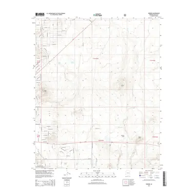
2014 Map of Vernon
USGS Topo · Published 2014About this map
Vernon sits at the southern edge of this high-desert plateau, where the landscape transitions into the wooded borders of the Sitgreaves National Forest. The geography is defined by a series of volcanic knolls and intermittent water sources, including the significant Laguna Salada and the smaller Anderson Lake to the south. Historically, this area has relied on a network of drainages such as Sepulveda Cr and Mineral Cr to sustain ranching and early settlement.
Find a feature on this map
61 named features on this map. Tap any name to fly to it.
Don’t see what you’re looking for? This feature index may not catch every label — zoom into the map to look around manually.
Map Details
Editions of this 2014 Vernon Map
This is the sole edition of this map. No revisions or reprints were ever made.
Other maps of this area

1886 · St Johns
USGS Topo · 1:250,000

1892 · St Johns
USGS Topo · 1:250,000

1954 · Saint Johns
USGS Topo · 1:250,000

1957 · Saint Johns
USGS Topo · 1:250,000

1958 · Saint Johns
USGS Topo · 1:250,000

1961 · McNary
USGS Topo · 1:62,500

1962 · Saint Johns
USGS Topo · 1:250,000

1968 · Boundary Butte
USGS Topo · 1:24,000

1969 · Whiting Knoll
USGS Topo · 1:24,000
1971 · Cerro Hueco
USGS Topo · 1:24,000