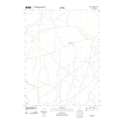
2011 Map of Vernon NE
USGS Topo · Published 2011About this map
The Rush Valley Pony Express Station Historical Marker serves as a primary focal point in this high-desert landscape of Tooele County. Located along Faust Rd, the site marks a critical stop on the historical mail route that once traversed the central Utah territory. The terrain is defined by the gradual slopes of the Vernon Hills in the southwest, giving way to the open expanses of Rush Valley. Water sources are sparse but significant to the area's geography, notably Sabie Creek and Boulter Creek, which drain toward the valley floor. The map captures a moment in the early 21st century where the modern road network follows much of the same path as the pioneer-era trails, illustrating the enduring influence of the original Pony Express route on the local infrastructure.
Find a feature on this map
5 named features on this map. Tap any name to fly to it.
Don’t see what you’re looking for? This feature index may not catch every label — zoom into the map to look around manually.
Map Details
Editions of this 2011 Vernon NE Map
This is the sole edition of this map. No revisions or reprints were ever made.
Other maps of this area

1885 · Tooele Valley
USGS Topo · 1:250,000

1915 · Fairfield
USGS Topo · 1:62,500

1917 · Fairfield
USGS Topo · 1:62,500

1918 · Stockton
USGS Topo · 1:62,500

1947 · Fivemile Pass
USGS Topo · 1:62,500

1947 · Boulter Peak
USGS Topo · 1:24,000

1949 · Fivemile Pass
USGS Topo · 1:24,000

1953 · Tooele
USGS Topo · 1:250,000

1955 · Stockton
USGS Topo · 1:62,500

1955 · Tooele
USGS Topo · 1:250,000