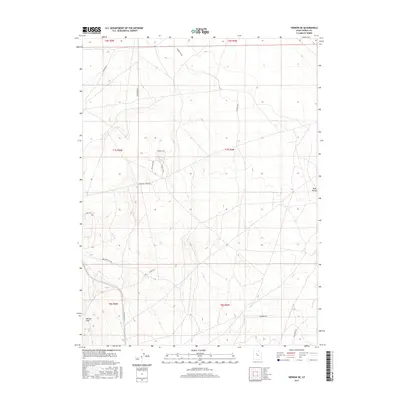
2017 Map of Vernon NE
USGS Topo · Published 2017About this map
Rush Valley dominates this Tooele County landscape, where the terrain transitions from open flats toward the rising slopes of the Vernon Hills. This 2017 survey reveals a complex network of utilitarian routes designed for land management and resource exploration, including Drill Hole Rd and Prospects Rd, which hint at the region's long-standing connection to geological study and mineral prospecting. The drainage pattern is defined by the seasonal flow of Sabie Cr and Boulter Cr, cutting through the valley floor. Regional access is anchored by established thoroughfares such as Jericho Rd and Rangeline Rd, illustrating the systematic public land survey system grid that governs this part of Utah. The naming conventions of local paths, like Hawkeye Rd and Goldeneye Rd, reflect the local character of the high desert environment.
Find a feature on this map
24 named features on this map. Tap any name to fly to it.
Don’t see what you’re looking for? This feature index may not catch every label — zoom into the map to look around manually.
Map Details
Editions of this 2017 Vernon NE Map
This is the sole edition of this map. No revisions or reprints were ever made.
Other maps of this area

1885 · Tooele Valley
USGS Topo · 1:250,000

1915 · Fairfield
USGS Topo · 1:62,500

1917 · Fairfield
USGS Topo · 1:62,500

1918 · Stockton
USGS Topo · 1:62,500

1947 · Fivemile Pass
USGS Topo · 1:62,500

1947 · Boulter Peak
USGS Topo · 1:24,000

1949 · Fivemile Pass
USGS Topo · 1:24,000

1953 · Tooele
USGS Topo · 1:250,000

1955 · Stockton
USGS Topo · 1:62,500

1955 · Tooele
USGS Topo · 1:250,000