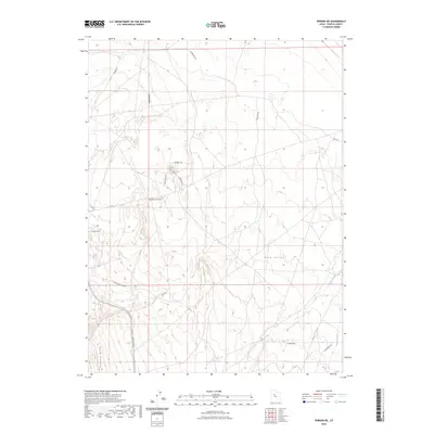
2023 Map of Vernon NE
USGS Topo · Published 2023About this map
Rush Valley dominates this Tooele County landscape, where the terrain transitions from the broad valley floor into the rising elevations of the Vernon Hills in the southwest. This 2023 survey by the U.S. Geological Survey documents a network of industrial and access roads that suggest a history of resource exploration and land management. Small watercourses like Sable Creek and Boulter Creek provide drainage in the southeastern corner, while the presence of Drill Hole Rd, Prospect Rd, and Prospects Rd points to the area's geological significance and potential mineral interests. The infrastructure is characterized by a sparse grid of named tracks, including Rangeline Rd and RR Access Rd, illustrating how this part of the Great Basin is navigated for ranching, utility maintenance, and local transit.
Find a feature on this map
19 named features on this map. Tap any name to fly to it.
Don’t see what you’re looking for? This feature index may not catch every label — zoom into the map to look around manually.
Map Details
Editions of this 2023 Vernon NE Map
This is the sole edition of this map. No revisions or reprints were ever made.
Other maps of this area

1885 · Tooele Valley
USGS Topo · 1:250,000

1915 · Fairfield
USGS Topo · 1:62,500

1917 · Fairfield
USGS Topo · 1:62,500

1918 · Stockton
USGS Topo · 1:62,500

1947 · Fivemile Pass
USGS Topo · 1:62,500

1947 · Boulter Peak
USGS Topo · 1:24,000

1949 · Fivemile Pass
USGS Topo · 1:24,000

1953 · Tooele
USGS Topo · 1:250,000

1955 · Stockton
USGS Topo · 1:62,500

1955 · Tooele
USGS Topo · 1:250,000