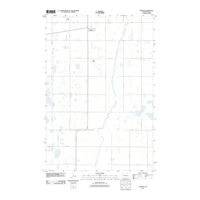
2011 Map of Verona
USGS Topo · Published 2011About this map
Verona serves as the primary settlement in this part of LaMoure County, situated in the upper portion of the map where 1st Ave and 2nd Ave form the local street grid. The surrounding prairie landscape is defined by a dense network of sectional roads, including 110th Ave SE and 114th Ave SE, which organize the agricultural terrain. For those researching local family history, two notable burial sites are recorded: Pilgrims Rest Cemetery at the northern edge and Saint Raphael Cemetery further south. The serpentine path of Bear Creek winds through the eastern half of the township, creating a natural break in the rigid grid of rural roads. This 2011 survey reflects the enduring structure of North Dakota’s farming communities, where small settlements like Verona remain anchored by long-established landmarks and the persistent hydrology of the prairie potholes.
Find a feature on this map
22 named features on this map. Tap any name to fly to it.
Don’t see what you’re looking for? This feature index may not catch every label — zoom into the map to look around manually.
Map Details
Editions of this 2011 Verona Map
This is the sole edition of this map. No revisions or reprints were ever made.
Other maps of this area

1894 · Oakes
USGS Topo · 1:62,500

1895 · Lamoure
USGS Topo · 1:125,000

1918 · La Moure
USGS Topo · 1:125,000

1952 · Glover
USGS Topo · 1:24,000

1952 · Oakes
USGS Topo · 1:24,000

1952 · Crete
USGS Topo · 1:24,000

1952 · Independence
USGS Topo · 1:24,000

1953 · Jamestown
USGS Topo · 1:250,000

1953 · Fargo
USGS Topo · 1:250,000

1956 · Fargo
USGS Topo · 1:250,000