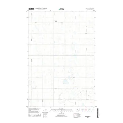
2014 Map of Verona NW
USGS Topo · Published 2014About this map
Benson Corner serves as a lone point of reference in this corner of North Dakota, situated at the intersection of 64th St Se and 106th Ave Se. The landscape is dominated by the glacial prairie pothole region, where numerous small, unnamed wetlands and depressions are scattered across the township grid. In the southwestern corner of the quadrangle, Twin Lakes marks one of the few named water bodies in an area otherwise characterized by a strictly regulated section-line road system. The map reflects the enduring agricultural organization of the Great Plains, where long stretches of numbered routes like 71st St Se and 104th Ave Se define the movement and settlement patterns of this rural expanse.
Find a feature on this map
16 named features on this map. Tap any name to fly to it.
Don’t see what you’re looking for? This feature index may not catch every label — zoom into the map to look around manually.
Map Details
Editions of this 2014 Verona NW Map
This is the sole edition of this map. No revisions or reprints were ever made.
Other maps of this area

1894 · La Moure
USGS Topo · 1:62,500

1895 · Lamoure
USGS Topo · 1:125,000

1897 · Eckelson
USGS Topo · 1:125,000

1918 · La Moure
USGS Topo · 1:125,000

1952 · Grand Rapids
USGS Topo · 1:24,000

1952 · Independence
USGS Topo · 1:24,000

1953 · Jamestown
USGS Topo · 1:250,000
1955 · La Moure
USGS Topo · 1:24,000

1956 · Jamestown
USGS Topo · 1:250,000
1970 · Verona NW
USGS Topo · 1:24,000
Featured Places
- Black Loam Township, ND
- Gladstone Township, ND
- Benson Corner, ND
- Pearl Lake Township, ND
- Greenville Township, ND