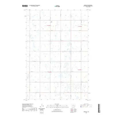
2020 Map of Verona NW
USGS Topo · Published 2020About this map
High Prairie Cem stands as a primary landmark in this rural section of LaMoure County, situated near the intersection of 64th St SE and Co Rd 60. The landscape is defined by the section-line grid system characteristic of North Dakota's agricultural heartland, with a dense network of local roads such as 104th Ave SE and 109th Ave SE providing access to numerous prairie potholes and seasonal wetlands. These glacial depressions dot the terrain across townships t135n r60w and t134n r59w, illustrating the complex local hydrology that persists alongside large-scale farming operations. This survey captures the enduring spatial organization of the Black Loam Township area, where the placement of cemeteries and the rigid road network like Co Rd 34 reflect the historical settlement patterns of the region.
Find a feature on this map
19 named features on this map. Tap any name to fly to it.
Don’t see what you’re looking for? This feature index may not catch every label — zoom into the map to look around manually.
Map Details
Editions of this 2020 Verona NW Map
This is the sole edition of this map. No revisions or reprints were ever made.
Other maps of this area

1894 · La Moure
USGS Topo · 1:62,500

1895 · Lamoure
USGS Topo · 1:125,000

1897 · Eckelson
USGS Topo · 1:125,000

1918 · La Moure
USGS Topo · 1:125,000

1952 · Grand Rapids
USGS Topo · 1:24,000

1952 · Independence
USGS Topo · 1:24,000

1953 · Jamestown
USGS Topo · 1:250,000
1955 · La Moure
USGS Topo · 1:24,000

1956 · Jamestown
USGS Topo · 1:250,000
1970 · Verona NW
USGS Topo · 1:24,000
Featured Places
- Black Loam Township, ND
- Gladstone Township, ND
- Benson Corner, ND
- Pearl Lake Township, ND
- Greenville Township, ND