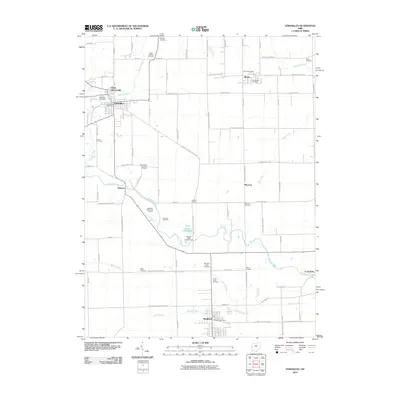
2010 Map of Versailles
USGS Topo · Published 2010About this map
The Stillwater River carves a winding path across this landscape, connecting the regional centers of Versailles and Bradford during the early 21st century. This survey reveals a dense network of rural communities and crossroads, including Russia, Webster, and Bloomer, each serving as a focal point for the surrounding agricultural tracts. The area is notable for its high concentration of family and community burial grounds, such as Saint Valberts Cemetery, Greenlawn Cemetery, and the Old Harris Creek Cemetery, which offer significant value for genealogical research in Darke County.
Find a feature on this map
85 named features on this map. Tap any name to fly to it.
Don’t see what you’re looking for? This feature index may not catch every label — zoom into the map to look around manually.
Map Details
Editions of this 2010 Versailles Map
This is the sole edition of this map. No revisions or reprints were ever made.
Other maps of this area

1908 · St. Henry
USGS Topo · 1:62,500

1909 · Loramie
USGS Topo · 1:62,500

1911 · Loramie
USGS Topo · 1:62,500

1911 · Covington
USGS Topo · 1:62,500

1944 · Covington
USGS Topo · 1:62,500

1944 · Loramie
USGS Topo · 1:62,500

1953 · Muncie
USGS Topo · 1:250,000

1956 · Muncie
USGS Topo · 1:250,000

1961 · Dawn
USGS Topo · 1:24,000
1961 · Piqua West
USGS Topo · 1:24,000