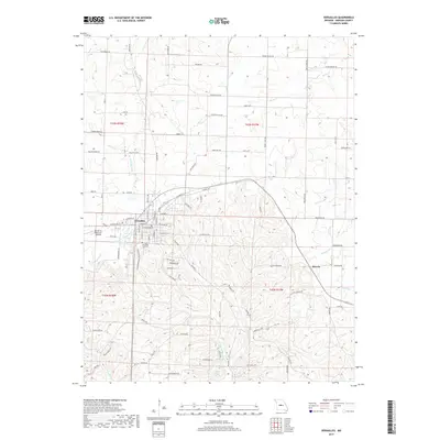
2017 Map of Versailles
USGS Topo · Published 2017About this map
Versailles serves as the central hub of this Missouri landscape, with its residential grid extending from W Newton St and E Newton St toward the Versailles City Cem. The town's western edge is marked by the Roy Otten Memorial Airfield, while the surrounding terrain is defined by a dense network of watercourses and rural corridors. The drainage pattern is complex, featuring the Straight Fork and Little Gravois Cr, which carve through the topography alongside smaller features like James Mill Spring and Cades Cove. To the east, the settlement of Marvin sits near the confluence of Burris Fork and Gracey Cr. This road network, including the eponymous Smith Creek Rd and Mount Zion Rd, illustrates the persistent rural-to-town connection common in the Ozark border region, where agricultural land and small community centers are linked by names like Sale Barn Rd and Country Club Rd.
Find a feature on this map
91 named features on this map. Tap any name to fly to it.
Don’t see what you’re looking for? This feature index may not catch every label — zoom into the map to look around manually.
Map Details
Editions of this 2017 Versailles Map
This is the sole edition of this map. No revisions or reprints were ever made.
Other maps of this area

1888 · Versailles
USGS Topo · 1:125,000

1888 · Boonville
USGS Topo · 1:125,000

1893 · Versailles
USGS Topo · 1:125,000

1904 · Eldon
USGS Topo · 1:62,500

1904 · Gravois Mills
USGS Topo · 1:62,500

1935 · Gravois Mills
USGS Topo · 1:24,000

1935 · Proctor Creek
USGS Topo · 1:24,000

1935 · Rocky Mount
USGS Topo · 1:24,000

1947 · Jefferson City
USGS Topo · 1:250,000

1949 · Gravois Mills
USGS Topo · 1:62,500