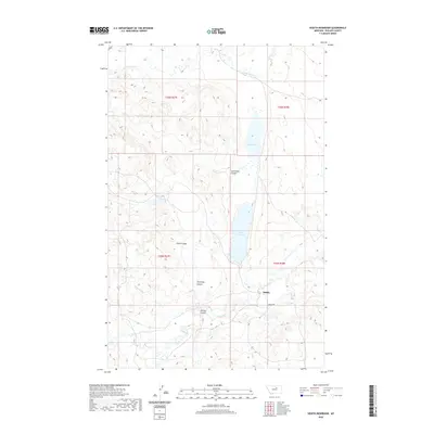
2020 Map of Veseth Reservoir
USGS Topo · Published 2020About this map
Midale stands as a focal point in this portion of Phillips County, where the high plains are deeply etched by an intricate network of drainage features. The landscape is defined by its water management and natural erosion patterns, centered on the Veseth Reservoir and the adjacent Veseth Flat. This region of Montana relies on the seasonal flow of Beaver Cr and Little Warm Cr, which have carved out distinct topographical depressions including Sevenmile Coulee and Hemming Coulee.
Find a feature on this map
15 named features on this map. Tap any name to fly to it.
Don’t see what you’re looking for? This feature index may not catch every label — zoom into the map to look around manually.
Map Details
Editions of this 2020 Veseth Reservoir Map
This is the sole edition of this map. No revisions or reprints were ever made.
Other maps of this area

1953 · Havre
USGS Topo · 1:250,000

1954 · Lewistown
USGS Topo · 1:250,000

1957 · Havre
USGS Topo · 1:250,000

1958 · Havre
USGS Topo · 1:250,000

1959 · Lewistown
USGS Topo · 1:250,000

1965 · Veseth Reservoir
USGS Topo · 1:24,000

1965 · Phillips
USGS Topo · 1:24,000

1965 · Dry Fork Ridge
USGS Topo · 1:24,000
1965 · Holzhey Reservoir
USGS Topo · 1:24,000
1965 · Barber Coulee
USGS Topo · 1:24,000