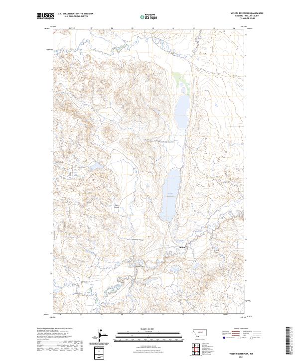
2024 Map of Veseth Reservoir
USGS Topo · Published 2024About this map
Veseth Reservoir dominates the drainage patterns of this Phillips County landscape, anchoring a network of intermittent streams and coulees that define the local topography. This region of Montana is characterized by a sparse settlement pattern, with Midale serving as a focal point along Midale Rd. The intricate system of waterways includes the meandering path of Beaver Creek in the south and the northern reach of Little Warm Creek.
Find a feature on this map
14 named features on this map. Tap any name to fly to it.
Don’t see what you’re looking for? This feature index may not catch every label — zoom into the map to look around manually.
Map Details
Editions of this 2024 Veseth Reservoir Map
This is the sole edition of this map. No revisions or reprints were ever made.
Other maps of this area

1953 · Havre
USGS Topo · 1:250,000

1954 · Lewistown
USGS Topo · 1:250,000

1957 · Havre
USGS Topo · 1:250,000

1958 · Havre
USGS Topo · 1:250,000

1959 · Lewistown
USGS Topo · 1:250,000

1965 · Veseth Reservoir
USGS Topo · 1:24,000

1965 · Phillips
USGS Topo · 1:24,000

1965 · Dry Fork Ridge
USGS Topo · 1:24,000
1965 · Holzhey Reservoir
USGS Topo · 1:24,000
1965 · Barber Coulee
USGS Topo · 1:24,000