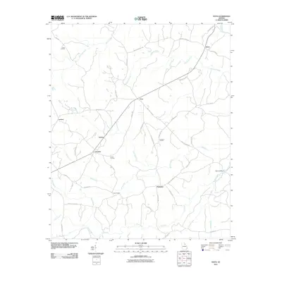
2011 Map of Vesta
USGS Topo · Published 2011About this map
Vesta serves as the central hub for a network of rural settlements in Oglethorpe County, where the landscape is defined by the winding paths of Goosepond Creek and Macks Creek. This 2011 survey illustrates a transition from the historic riverine economy of the north near Saxon, where the Broad River forms a natural boundary, to the more dispersed agricultural communities of Palmetto and Enterprise in the south. The distribution of local landmarks like Barbers Bridge and family-named roads suggests a deep-rooted pattern of land ownership. For researchers, the map provides precise locations for several family burial grounds, including the Hobbs Cemetery, Earl Bolton Cemetery, and Faust Cemetery, which are scattered among the ridges between Millstone Creek and Indian Creek.
Find a feature on this map
48 named features on this map. Tap any name to fly to it.
Don’t see what you’re looking for? This feature index may not catch every label — zoom into the map to look around manually.
Map Details
Editions of this 2011 Vesta Map
This is the sole edition of this map. No revisions or reprints were ever made.
Other maps of this area

1891 · Carnesville
USGS Topo · 1:125,000

1893 · Elberton
USGS Topo · 1:125,000

1906 · Crawfordville
USGS Topo · 1:125,000

1953 · Athens
USGS Topo · 1:250,000

1954 · Greenville
USGS Topo · 1:250,000

1958 · Greenville
USGS Topo · 1:250,000

1958 · Athens
USGS Topo · 1:250,000

1958 · Danielsville
USGS Topo · 1:62,500

1958 · Elberton
USGS Topo · 1:62,500

1959 · Athens
USGS Topo · 1:250,000