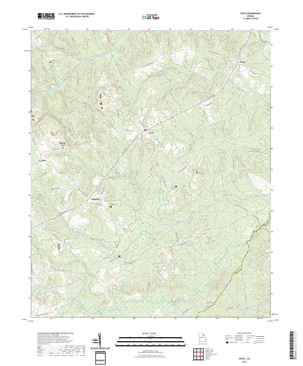
2024 Map of Vesta
USGS Topo · Published 2024About this map
The Broad River forms the northeastern boundary of this landscape in Oglethorpe and Wilkes counties, where rural life is defined by small crossroads settlements and family-named landmarks. The village of Vesta sits at the junction of Elberton Rd and Vesta Palmetto Rd, serving as a central point for the surrounding agricultural community. To the west, the aptly named Veribest and Enterprise anchor the road network, while Saxon occupies the northern reaches near Goosepond Creek. This area is particularly rich in genealogical data, with numerous burial sites such as Earl Bolton Cem, New Hope Cem, and Bridges Cem scattered across the creek-fed lowlands. The drainage patterns of Macks Creek and Long Creek dictate the local geography, leading down toward the wetlands of Duck Pond and Dry Fork Creek in the southeast.
Find a feature on this map
58 named features on this map. Tap any name to fly to it.
Don’t see what you’re looking for? This feature index may not catch every label — zoom into the map to look around manually.
Map Details
Editions of this 2024 Vesta Map
This is the sole edition of this map. No revisions or reprints were ever made.
Other maps of this area

1891 · Carnesville
USGS Topo · 1:125,000

1893 · Elberton
USGS Topo · 1:125,000

1906 · Crawfordville
USGS Topo · 1:125,000

1953 · Athens
USGS Topo · 1:250,000

1954 · Greenville
USGS Topo · 1:250,000

1958 · Greenville
USGS Topo · 1:250,000

1958 · Athens
USGS Topo · 1:250,000

1958 · Danielsville
USGS Topo · 1:62,500

1958 · Elberton
USGS Topo · 1:62,500

1959 · Athens
USGS Topo · 1:250,000