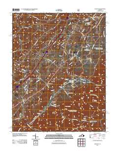
2011 Map of Vesuvius
USGS Topo · Published 2011About this map
Steeles Tavern and Vesuvius anchor this portion of the Shenandoah Valley, where the landscape transitions from rolling agricultural land into the steep rises of the Blue Ridge. The course of the South River serves as a central geographical axis, punctuated by water management features such as the South River Number Three Dam and South River Number Four Dam. To the north, the State Prison Camp Number 10 reflects the area's institutional history, while the rural character is maintained by landmarks like the Brook Hill Farm Airport and small settlements like Lofton and Raphine.
Find a feature on this map
73 named features on this map. Tap any name to fly to it.
Don’t see what you’re looking for? This feature index may not catch every label — zoom into the map to look around manually.
Map Details
Editions of this 2011 Vesuvius Map
This is the sole edition of this map. No revisions or reprints were ever made.
Other maps of this area

1894 · Staunton
USGS Topo · 1:125,000

1894 · Lexington
USGS Topo · 1:125,000

1932 · Lexington
USGS Topo · 1:48,000

1936 · Vesuvius
USGS Topo · 1:48,000

1937 · Lexington
USGS Topo · 1:62,500

1941 · Vesuvius
USGS Topo · 1:62,500

1943 · Craigsville
USGS Topo · 1:62,500

1944 · Staunton
USGS Topo · 1:62,500

1945 · Craigsville
USGS Topo · 1:62,500

1947 · Staunton
USGS Topo · 1:62,500