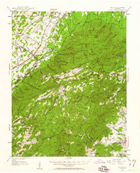
1950 Map of Vesuvius
USGS Topo · Published 1960About this map
Montebello and Massies Mill anchor this mid-century view of the Blue Ridge, where the highland economy is defined by transit and resource management. The Norfolk and Western railroad and the Lee Highway traverse the valley floor near Steeles Tavern, while higher elevations are dominated by the Big Levels Game Refuge and the Blue Ridge Parkway. The map documents a social landscape of isolated institutions, including the State Prison Camp No 10, the State Trout Nursery, and remote educational outposts like Panther Mtn Sch and Clark Mtn Mission. Industrial traces are evident through the Kennedy Mine and a high-altitude Aerial Tramway near Minebank Mtn. This survey captures the region just as the Appalachian Trail was becoming a permanent fixture of the mountain crests, winding past landmarks like Spy Rock and through Tye River Gap.
Find a feature on this map
146 named features on this map. Tap any name to fly to it.
Don’t see what you’re looking for? This feature index may not catch every label — zoom into the map to look around manually.
Map Details
Editions of this 1950 Vesuvius Map
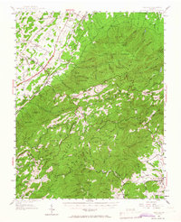
2 editions found
Other maps of this area

1892 · Buckingham
USGS Topo · 1:125,000

1892 · Harrisonburg
USGS Topo · 1:125,000

1894 · Staunton
USGS Topo · 1:125,000

1894 · Lexington
USGS Topo · 1:125,000

1932 · Lexington
USGS Topo · 1:48,000

1934 · Waynesboro
USGS Topo · 1:48,000

1935 · Buena Vista
USGS Topo · 1:48,000

1935 · Amherst
USGS Topo · 1:48,000

1936 · Vesuvius
USGS Topo · 1:48,000

1937 · Lexington
USGS Topo · 1:62,500