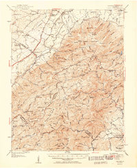
1951 Map of Vesuvius
USGS Topo · Published 1951About this map
Greenville and Steeles Tavern anchor the northern landscape of this mid-century topographic study, where the Blue Ridge Mountains transition into the rolling valley floor. The map documents a complex industrial and social history, including the State Prison Camp No 10 and the Aerial Tramway serving the Clay Pit near Ellard. To the east, the Big Levels Game Refuge spans high plateaus such as Big Levels, while the southern reaches reveal remote settlements like Irish Creek and Montebello. These mountain communities were served by institutions like the Panther Mtn Sch and the Irish Creek Mission. For those researching local commerce, the Norfolk and Western Ry runs through the valley, connecting Vesuvius and Spottswood, while extractive industries are marked by the Kennedy Mine and the Cellar Mtn Red Min Mine.
Find a feature on this map
166 named features on this map. Tap any name to fly to it.
Don’t see what you’re looking for? This feature index may not catch every label — zoom into the map to look around manually.
Map Details
Editions of this 1951 Vesuvius Map
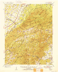
2 editions found
Other maps of this area

1892 · Buckingham
USGS Topo · 1:125,000

1892 · Harrisonburg
USGS Topo · 1:125,000

1894 · Staunton
USGS Topo · 1:125,000

1894 · Lexington
USGS Topo · 1:125,000

1932 · Lexington
USGS Topo · 1:48,000

1934 · Waynesboro
USGS Topo · 1:48,000

1935 · Buena Vista
USGS Topo · 1:48,000

1935 · Amherst
USGS Topo · 1:48,000

1936 · Vesuvius
USGS Topo · 1:48,000

1937 · Lexington
USGS Topo · 1:62,500