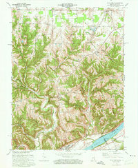
1971 Map of Vevay North
USGS Topo · Published 1973About this map
The Ohio River defines the southern edge of this Switzerland County landscape, where the bustling river town of Vevay serves as a historic anchor for the surrounding uplands. The terrain is deeply etched by numerous drainages such as Indian Creek, Plum Creek, and Tapps Creek, which carve out a series of prominent ridges including Pleasant Ridge and the distinctively named Popcorn Ridge. This 1971 survey captures the area’s rural character, marked by small crossroad settlements like Mt Sterling and Jacksonville and local gathering places like Fredonia Ch and Plum Creek Ch.
Find a feature on this map
49 named features on this map. Tap any name to fly to it.
Don’t see what you’re looking for? This feature index may not catch every label — zoom into the map to look around manually.
Map Details
Editions of this 1971 Vevay North Map
Other maps of this area

1943 · Florence
USGS Topo · 1:24,000

1943 · Aberdeen
USGS Topo · 1:24,000

1943 · Vevay North
USGS Topo · 1:24,000

1943 · Brooksburg
USGS Topo · 1:24,000

1943 · Vevay South
USGS Topo · 1:24,000

1951 · Florence
USGS Topo · 1:24,000

1951 · Sanders
USGS Topo · 1:24,000

1952 · Vevay South
USGS Topo · 1:24,000

1953 · Carrollton
USGS Topo · 1:24,000

1953 · Aberdeen
USGS Topo · 1:24,000