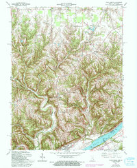
1971 Map of Vevay North
USGS Topo · Published 1994About this map
Vevay stands prominently along the northern bank of the Ohio River in this detailed survey of south-central Switzerland County. The settlement pattern is defined by the sharp transition from the river bottomlands to the interior uplands, where narrow ridges like Popcorn Ridge and Pleasant Ridge dictated the paths of early travel routes. Small communities such as Mt Sterling, Center Square, and Jacksonville are clustered at key high-ground intersections, serving the agricultural hinterland above the river valley.
Find a feature on this map
31 named features on this map. Tap any name to fly to it.
Don’t see what you’re looking for? This feature index may not catch every label — zoom into the map to look around manually.
Map Details
Editions of this 1971 Vevay North Map
Other maps of this area

1943 · Florence
USGS Topo · 1:24,000

1943 · Aberdeen
USGS Topo · 1:24,000

1943 · Vevay North
USGS Topo · 1:24,000

1943 · Brooksburg
USGS Topo · 1:24,000

1943 · Vevay South
USGS Topo · 1:24,000

1951 · Florence
USGS Topo · 1:24,000

1951 · Sanders
USGS Topo · 1:24,000

1952 · Vevay South
USGS Topo · 1:24,000

1953 · Carrollton
USGS Topo · 1:24,000

1953 · Aberdeen
USGS Topo · 1:24,000