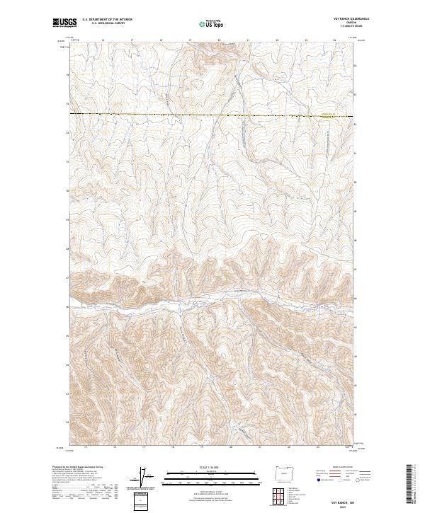
2023 Map of Vey Ranch
USGS Topo · Published 2023About this map
Service Buttes rise above the high plateau in a landscape defined by deep drainages and intermittent watercourses. This modern survey of the borderlands between Umatilla Co and Morrow Co shows a region where human activity is primarily limited to resource management and livestock transit, following long-established routes like Service Butte Rd and Natl Forest Develop Road 825 Rd. The terrain is carved by complex canyon systems, including Ayers Canyon, Morris Canyon, and Matlock Canyon, all feeding toward the drainage of Butter Creek which cuts through the center of the quadrangle. These names often reflect early homesteaders or ranching families who managed the range in this part of northeastern Oregon. The alignment of Big Butter Creek Ln highlights the enduring importance of the creek valley as a primary corridor through this isolated country.
Find a feature on this map
18 named features on this map. Tap any name to fly to it.
Don’t see what you’re looking for? This feature index may not catch every label — zoom into the map to look around manually.
Map Details
Editions of this 2023 Vey Ranch Map
This is the sole edition of this map. No revisions or reprints were ever made.
Other maps of this area

1908 · Umatilla
USGS Topo · 1:125,000

1953 · Pendleton
USGS Topo · 1:250,000

1956 · Pendleton
USGS Topo · 1:250,000

1968 · Service Buttes NW
USGS Topo · 1:24,000

1968 · Lena
USGS Topo · 1:24,000
1968 · Echo
USGS Topo · 1:24,000

1968 · Gleason Butte
USGS Topo · 1:24,000

1968 · Vey Ranch
USGS Topo · 1:24,000

1968 · Butter Creek Junction
USGS Topo · 1:24,000
1968 · Service Buttes
USGS Topo · 1:24,000