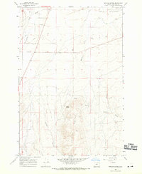
1968 Map of Service Buttes
USGS Topo · Published 1970About this map
Oregon Trail remnants cut across the arid landscape of Umatilla County in this late 1960s survey, marking a historic corridor through the high desert. The terrain is defined by the prominent Service Buttes and the winding course of Butter Creek in the northwest. This area serves as a transition between the irrigated lowlands and the higher, more broken country to the south.
Find a feature on this map
18 named features on this map. Tap any name to fly to it.
Don’t see what you’re looking for? This feature index may not catch every label — zoom into the map to look around manually.
Map Details
Editions of this 1968 Service Buttes Map
This is the sole edition of this map. No revisions or reprints were ever made.
Other maps of this area

1908 · Umatilla
USGS Topo · 1:125,000

1953 · Pendleton
USGS Topo · 1:250,000

1956 · Pendleton
USGS Topo · 1:250,000

1962 · Stanfield
USGS Topo · 1:24,000

1962 · Ordnance
USGS Topo · 1:24,000

1962 · Hermiston
USGS Topo · 1:24,000

1968 · Service Buttes NW
USGS Topo · 1:24,000
1968 · Echo
USGS Topo · 1:24,000

1968 · Vey Ranch
USGS Topo · 1:24,000

1968 · Butter Creek Junction
USGS Topo · 1:24,000