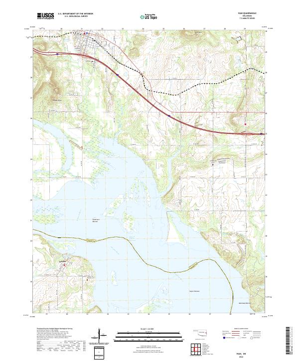
2022 Map of Vian
USGS Topo · Published 2022About this map
Vian sits at the northern edge of this landscape, its grid of streets such as Main St and Schley St transitioning into the rural reaches of Sequoyah County. The terrain is defined by the expansive Robert S Kerr Reservoir and the Arkansas River, which forms the southern boundary against Haskell County. These waterways have shaped a series of low-lying areas including Sandtown Bottom, Saylor Bottom, and Mulehead Bottom.
Find a feature on this map
66 named features on this map. Tap any name to fly to it.
Don’t see what you’re looking for? This feature index may not catch every label — zoom into the map to look around manually.
Map Details
Editions of this 2022 Vian Map
This is the sole edition of this map. No revisions or reprints were ever made.
Other maps of this area

1898 · Tahlequah
USGS Topo · 1:125,000

1900 · Sansbois
USGS Topo · 1:125,000

1900 · Sallisaw
USGS Topo · 1:125,000

1901 · Muscogee
USGS Topo · 1:125,000

1901 · Tahlequah
USGS Topo · 1:125,000

1905 · Muscogee
USGS Topo · 1:125,000

1905 · Tahlequah
USGS Topo · 1:125,000

1909 · Sans Bois
USGS Topo · 1:125,000

1911 · Sallisaw
USGS Topo · 1:125,000

1911 · Sansbois
USGS Topo · 1:125,000