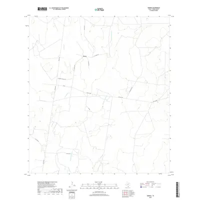
2019 Map of Viboras
USGS Topo · Published 2019About this map
Viboras serves as a central reference point in this corner of Starr County, where the landscape is defined by the winding paths of Los Olmos Cr and Remadura de Sandia Cr. The map reveals a network of roads named for local families and ranching heritage, including Villarreal Rd and Alejandro Guerra Rch Rd. These family-named landmarks suggest a deep-rooted ranching economy that has persisted into the modern era. The drainage patterns of the creeks, indicated by dense contouring in the south, contrast with the more open stretches traversed by Fm 2686 and Ranch Rd 649, illustrating how water and transportation corridors have shaped the settlement patterns of this South Texas region.
Find a feature on this map
13 named features on this map. Tap any name to fly to it.
Don’t see what you’re looking for? This feature index may not catch every label — zoom into the map to look around manually.
Map Details
Editions of this 2019 Viboras Map
This is the sole edition of this map. No revisions or reprints were ever made.
Other maps of this area

1938 · El Sauz
USGS Topo · 1:62,500

1938 · Agua Nueva
USGS Topo · 1:62,500

1938 · Sal Colorada
USGS Topo · 1:62,500

1938 · Cuevitas
USGS Topo · 1:62,500

1949 · Mc Allen
USGS Topo · 1:250,000

1954 · McAllen
USGS Topo · 1:250,000

1957 · Mc Allen
USGS Topo · 1:250,000

1962 · McAllen
USGS Topo · 1:250,000

1972 · Cuevitas
USGS Topo · 1:24,000
1972 · Viboras
USGS Topo · 1:24,000