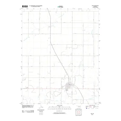
2010 Map of Vici
USGS Topo · Published 2010About this map
Vici serves as the central hub of this Dewey County landscape, situated at the intersection of major state routes and local roads. The town's infrastructure is anchored by the Vici Municipal Airport to the south, reflecting its role as a regional transport point. The surrounding rural terrain is defined by a grid of section-line roads such as n2070 RD and e0570 RD, which partition the drainage basins of several local waterways. To the west of the town center lies the Vassar Cemetery, providing a specific point of interest for genealogical research in this part of Oklahoma. The hydrology of the area is shaped by the winding courses of South Persimmon Creek in the north and the southern reaches of Trail Creek and Cottonwood Creek, which together illustrate the natural drainage patterns of this prairie environment.
Find a feature on this map
23 named features on this map. Tap any name to fly to it.
Don’t see what you’re looking for? This feature index may not catch every label — zoom into the map to look around manually.
Map Details
Editions of this 2010 Vici Map
This is the sole edition of this map. No revisions or reprints were ever made.
Other maps of this area

1955 · Woodward
USGS Topo · 1:250,000

1958 · Woodward
USGS Topo · 1:250,000

1969 · Vici NW
USGS Topo · 1:24,000

1969 · Woodward SW
USGS Topo · 1:24,000

1969 · Sharon
USGS Topo · 1:24,000

1969 · Mooreland SW
USGS Topo · 1:24,000

1969 · Mutual SW
USGS Topo · 1:24,000

1969 · Mutual
USGS Topo · 1:24,000

1969 · Camargo
USGS Topo · 1:24,000

1969 · Vici
USGS Topo · 1:24,000