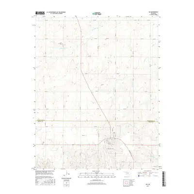
2016 Map of Vici
USGS Topo · Published 2016About this map
Vici serves as the central hub of this Northwest Oklahoma landscape, situated at the junction of several primary roads and the southern end of a prominent north-south transit corridor. The town layout is clearly defined by a grid of streets including Main St, Broadway St, and First St, supporting the local community and the nearby Vici Municipal Airport. This area is characterized by a high-plains drainage system where numerous creeks, such as S Persimmon Cr and Hackberry Cr, carve through the terrain. Evidence of early settlement and genealogy is found at the South Persimmon Cem to the north and the Vassar Cem to the southwest. The boundary between Woodward Co and Dewey Co bisects the map, illustrating how the rural road network, including Hale Rd, adapts to both the political borders and the natural flow of Trail Cr and Cottonwood Cr.
Find a feature on this map
33 named features on this map. Tap any name to fly to it.
Don’t see what you’re looking for? This feature index may not catch every label — zoom into the map to look around manually.
Map Details
Editions of this 2016 Vici Map
This is the sole edition of this map. No revisions or reprints were ever made.
Other maps of this area

1955 · Woodward
USGS Topo · 1:250,000

1958 · Woodward
USGS Topo · 1:250,000

1969 · Vici NW
USGS Topo · 1:24,000

1969 · Woodward SW
USGS Topo · 1:24,000

1969 · Sharon
USGS Topo · 1:24,000

1969 · Mooreland SW
USGS Topo · 1:24,000

1969 · Mutual SW
USGS Topo · 1:24,000

1969 · Mutual
USGS Topo · 1:24,000

1969 · Camargo
USGS Topo · 1:24,000

1969 · Vici
USGS Topo · 1:24,000