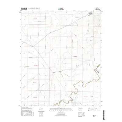
2017 Map of Vick
USGS Topo · Published 2017About this map
Johnsville and the surrounding timberlands of Bradley County are defined by the winding course of the Saline River, which forms the eastern boundary of this Arkansas landscape. The area is characterized by a low-lying, water-rich environment where the river creates distinctive features like Oxbow Bend, Robinson Bay, and Norrel Island. This proximity to the river supported early commerce at Moores Mill and established a network of rural settlements, including Vick and Broad, which remain connected by long-standing routes such as Ar 189.
Find a feature on this map
76 named features on this map. Tap any name to fly to it.
Don’t see what you’re looking for? This feature index may not catch every label — zoom into the map to look around manually.
Map Details
Editions of this 2017 Vick Map
This is the sole edition of this map. No revisions or reprints were ever made.
Other maps of this area

1934 · Ingalls
USGS Topo · 1:48,000

1934 · Felsenthal
USGS Topo · 1:62,500

1937 · Felsenthal
USGS Topo · 1:62,500

1937 · Ingalls
USGS Topo · 1:62,500

1938 · Felsenthal
USGS Topo · 1:62,500

1939 · Felsenthal
USGS Topo · 1:62,500

1939 · Ingalls
USGS Topo · 1:62,500

1953 · Greenwood
USGS Topo · 1:250,000

1953 · El Dorado
USGS Topo · 1:250,000

1956 · Greenwood
USGS Topo · 1:250,000