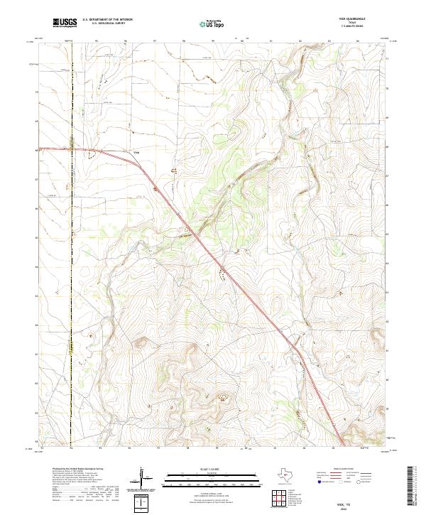
2022 Map of Vick
USGS Topo · Published 2022About this map
Vick serves as the focal point of this Concho County landscape, situated at the junction of FM 381 and US Highway 87. The terrain is defined by a series of intermittent drainages that carve through the Texas ranch land, including the winding course of Kickapoo Cr and its tributaries like Frog Pond Cr. The map captures the interface between Tom Green Co Concho Co, illustrating how the boundary line intersects local thoroughfares such as Co RD 1391 and Sanders Rd. North of the settlement, Dry Hollow cuts a distinct path through the topography, while Welch Cr drains the southern reaches. This modern survey provides an exact record of the rural road network, from established farm-to-market routes to the specialized PVT RD 1358, reflecting the enduring agricultural and ranching patterns of the region.
Find a feature on this map
18 named features on this map. Tap any name to fly to it.
Don’t see what you’re looking for? This feature index may not catch every label — zoom into the map to look around manually.
Map Details
Editions of this 2022 Vick Map
This is the sole edition of this map. No revisions or reprints were ever made.
Other maps of this area

1892 · San Angelo
USGS Topo · 1:125,000

1892 · Eden
USGS Topo · 1:125,000

1896 · Eden
USGS Topo · 1:125,000

1954 · Brownwood
USGS Topo · 1:250,000

1954 · San Angelo
USGS Topo · 1:250,000

1957 · Eola
USGS Topo · 1:62,500

1958 · San Angelo
USGS Topo · 1:250,000

1965 · San Angelo
USGS Topo · 1:250,000
1967 · Millersview NW
USGS Topo · 1:24,000
1967 · Millersview SW
USGS Topo · 1:24,000