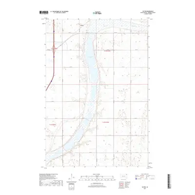
2017 Map of Victor
USGS Topo · Published 2017About this map
Victor serves as the primary settlement hub in this section of Roberts County, located just south of the North Dakota border. The landscape is defined by the elongated profile of Cottonwood Lake, which stretches north-to-south through the center of the quadrangle. This glacial terrain, typical of the Lake Traverse District, is characterized by extensive wetlands and seasonal water bodies like Big Slough, which dominates the northeastern corner. The map reveals a strictly regulated section-line road network, including Co Rd 12 and Co Rd 23, reflecting the enduring agricultural layout of the Dakotas. The intersection of these local routes with the modern interstate corridor illustrates the evolution of transport in this rural prairie environment.
Find a feature on this map
14 named features on this map. Tap any name to fly to it.
Don’t see what you’re looking for? This feature index may not catch every label — zoom into the map to look around manually.
Map Details
Editions of this 2017 Victor Map
This is the sole edition of this map. No revisions or reprints were ever made.
Other maps of this area

1915 · White Rock
USGS Topo · 1:62,500

1916 · Peever
USGS Topo · 1:62,500

1916 · Beardsley
USGS Topo · 1:62,500

1917 · New Effington
USGS Topo · 1:62,500

1918 · Peever
USGS Topo · 1:62,500

1918 · White Rock
USGS Topo · 1:62,500

1918 · Beardsley
USGS Topo · 1:62,500

1953 · Milbank
USGS Topo · 1:250,000

1958 · Milbank
USGS Topo · 1:250,000
1971 · Peever NW
USGS Topo · 1:24,000