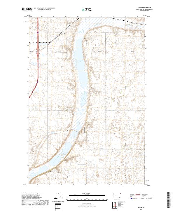
2021 Map of Victor
USGS Topo · Published 2021About this map
Victor sits at the northern edge of this Roberts County landscape, marking a modest concentration of settlement within a region defined by its complex glacial hydrology. The terrain is dominated by the linear progression of Cottonwood Lake and its extension into the Cottonwood Slough, which together carve a north-south path through the center of the survey. To the northeast, the expanse of Big Slough underscores the prairie wetland character of this territory. The systematic grid of rural roads, including Co Rd 12 and Co Rd 23, provides the framework for agricultural land divisions, with sections clearly delineated by the Public Land Survey System. This layout reveals the late twentieth-century and early twenty-first-century organization of the South Dakota prairie, where natural drainage features and human-engineered section lines coexist.
Find a feature on this map
21 named features on this map. Tap any name to fly to it.
Don’t see what you’re looking for? This feature index may not catch every label — zoom into the map to look around manually.
Map Details
Editions of this 2021 Victor Map
This is the sole edition of this map. No revisions or reprints were ever made.
Other maps of this area

1915 · White Rock
USGS Topo · 1:62,500

1916 · Peever
USGS Topo · 1:62,500

1916 · Beardsley
USGS Topo · 1:62,500

1917 · New Effington
USGS Topo · 1:62,500

1918 · Peever
USGS Topo · 1:62,500

1918 · White Rock
USGS Topo · 1:62,500

1918 · Beardsley
USGS Topo · 1:62,500

1953 · Milbank
USGS Topo · 1:250,000

1958 · Milbank
USGS Topo · 1:250,000
1971 · Peever NW
USGS Topo · 1:24,000