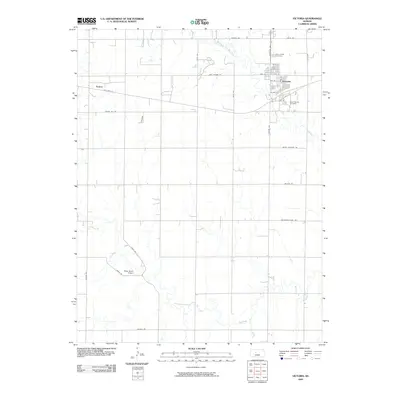
2009 Map of Victoria
USGS Topo · Published 2009About this map
Victoria serves as the central hub of this Ellis County landscape, situated along the railroad and Old Hwy 40. The town's grid is dense with residential streets like Iron St and Fern St, bookended by significant local burial grounds: Saint Fidelis Cemetery to the north and Saint George Cemetery to the south. To the west, the settlement of Toulon marks another point along the historic highway corridor, while the Philip Ranch Airport occupies the southwestern quadrant near the winding path of Big Creek.
Find a feature on this map
32 named features on this map. Tap any name to fly to it.
Don’t see what you’re looking for? This feature index may not catch every label — zoom into the map to look around manually.
Map Details
Editions of this 2009 Victoria Map
This is the sole edition of this map. No revisions or reprints were ever made.
Other maps of this area

1896 · Hays
USGS Topo · 1:125,000

1955 · Great Bend
USGS Topo · 1:250,000

1957 · Great Bend
USGS Topo · 1:250,000

1958 · Great Bend
USGS Topo · 1:250,000

1961 · Hays South
USGS Topo · 1:24,000

1961 · Catharine
USGS Topo · 1:24,000
1961 · Hays North
USGS Topo · 1:24,000
1961 · Walker
USGS Topo · 1:24,000

1961 · Victoria
USGS Topo · 1:24,000
1967 · Gorham
USGS Topo · 1:24,000