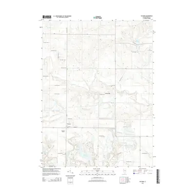
2015 Map of Victoria
USGS Topo · Published 2015About this map
Victoria serves as the primary hub in this portion of Knox County, defined by its traditional grid and proximity to the varied topography of Snakeden Hollow. The landscape is a complex arrangement of agricultural plateaus dissected by numerous watercourses, including Walnut Cr and Brandywine Cr. This area is notable for its extensive collection of surface water features, likely indicating the legacy of land reclamation and conservation, as seen at Snakeden Hollow Lake, Old Garage Lake, and Roundhouse Lake. For those tracing local heritage, several burial sites are documented across the township, including Victoria Cem, Smith Cem, and the more isolated Fraker Cem near Lake Calhoun. Smaller settlements like Centerville appear along the northern reaches of the county road network, maintaining their presence in this rural Illinois corridor.
Find a feature on this map
44 named features on this map. Tap any name to fly to it.
Don’t see what you’re looking for? This feature index may not catch every label — zoom into the map to look around manually.
Map Details
Editions of this 2015 Victoria Map
This is the sole edition of this map. No revisions or reprints were ever made.
Other maps of this area

1931 · Galva
USGS Topo · 1:48,000

1940 · Galva
USGS Topo · 1:62,500

1941 · Maquon
USGS Topo · 1:62,500

1943 · Maquon
USGS Topo · 1:62,500

1944 · Galva
USGS Topo · 1:62,500

1944 · Kewanee
USGS Topo · 1:62,500

1944 · Elmwood
USGS Topo · 1:62,500

1948 · Elmwood
USGS Topo · 1:62,500

1953 · Nekoma
USGS Topo · 1:24,000
1953 · Galva
USGS Topo · 1:24,000