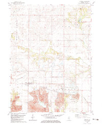
1982 Map of Victoria
USGS Topo · Published 1983About this map
Victoria serves as the primary hub in this portion of Knox County, surrounded by an agricultural and industrial landscape that was undergoing significant topographic changes in the early 1980s. To the south, massive Strip Mines and large areas of Tailings dominate the terrain, reflecting the region's intensive coal extraction history. This industrial footprint is further evidenced by the Industrial Railroad Grade and Old Railroad Grade that once facilitated the movement of resources through the area.
Find a feature on this map
29 named features on this map. Tap any name to fly to it.
Don’t see what you’re looking for? This feature index may not catch every label — zoom into the map to look around manually.
Map Details
Editions of this 1982 Victoria Map
This is the sole edition of this map. No revisions or reprints were ever made.
Other maps of this area

1931 · Galva
USGS Topo · 1:48,000

1940 · Galva
USGS Topo · 1:62,500

1941 · Maquon
USGS Topo · 1:62,500

1943 · Maquon
USGS Topo · 1:62,500

1944 · Galva
USGS Topo · 1:62,500

1944 · Kewanee
USGS Topo · 1:62,500

1944 · Elmwood
USGS Topo · 1:62,500

1948 · Elmwood
USGS Topo · 1:62,500

1953 · Nekoma
USGS Topo · 1:24,000
1953 · Galva
USGS Topo · 1:24,000