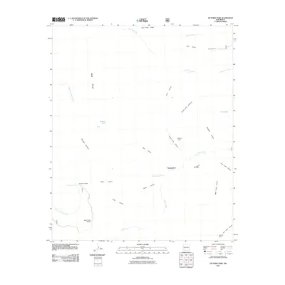
2011 Map of Victorio Park
USGS Topo · Published 2011About this map
McKnight Mountain and the high ridges of the Black Range dominate this 2011 survey of the high-desert wilderness. Human activity is sparse, marked primarily by the McKnight Fire Cabin and the secluded Murphy Place. These points of interest are connected by the winding Mcknight RD, reflecting the era's reliance on forest service access for management and fire watch. The landscape is deeply incised by drainages such as Massacre Canyon and Victorio Park Canyon, which funnel toward the Las Animas Creek. Vital water sources for the region's wildlife and sparse livestock are identified at Ridge Spring, McKnight Cabin Spring, and the high-altitude Mimbres Lake. From Spud Patch Ridge in the north to Granite Peak in the south, the map provides a look at the remote topography before modern developments reached this interior section of the range.
Find a feature on this map
34 named features on this map. Tap any name to fly to it.
Don’t see what you’re looking for? This feature index may not catch every label — zoom into the map to look around manually.
Map Details
Editions of this 2011 Victorio Park Map
This is the sole edition of this map. No revisions or reprints were ever made.
Other maps of this area

1935 · Hillsboro
USGS Topo · 1:48,000

1940 · Hillsboro
USGS Topo · 1:62,500

1954 · Tularosa
USGS Topo · 1:250,000

1955 · Las Cruces
USGS Topo · 1:250,000

1956 · San Lorenzo
USGS Topo · 1:62,500

1958 · Las Cruces
USGS Topo · 1:250,000

1958 · Tularosa
USGS Topo · 1:250,000

1963 · Bonner Canyon
USGS Topo · 1:24,000

1963 · Reeds Peak
USGS Topo · 1:24,000
1963 · Hay Mesa
USGS Topo · 1:24,000