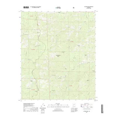
2020 Map of Victorio Park
USGS Topo · Published 2020About this map
The Black Range Crest defines the high-altitude landscape of this portion of the Gila National Forest, straddling the boundary between Grant and Sierra Counties. This 2020 survey documents a network of springs and drainage systems vital to the arid region, including the McKnight Cabin Spring and Geronimo Spring. The terrain is marked by named summits like McKnight Mtn and Victoria Park Mtn, which rise above deep canyons such as Massacre Canyon and Water Canyon.
Find a feature on this map
56 named features on this map. Tap any name to fly to it.
Don’t see what you’re looking for? This feature index may not catch every label — zoom into the map to look around manually.
Map Details
Editions of this 2020 Victorio Park Map
This is the sole edition of this map. No revisions or reprints were ever made.
Other maps of this area

1935 · Hillsboro
USGS Topo · 1:48,000

1940 · Hillsboro
USGS Topo · 1:62,500

1954 · Tularosa
USGS Topo · 1:250,000

1955 · Las Cruces
USGS Topo · 1:250,000

1956 · San Lorenzo
USGS Topo · 1:62,500

1958 · Las Cruces
USGS Topo · 1:250,000

1958 · Tularosa
USGS Topo · 1:250,000

1963 · Bonner Canyon
USGS Topo · 1:24,000

1963 · Reeds Peak
USGS Topo · 1:24,000
1963 · Hay Mesa
USGS Topo · 1:24,000