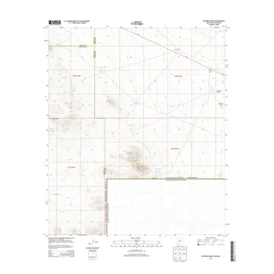
2013 Map of Victorio Ranch
USGS Topo · Published 2013About this map
Victorio Ranch anchors this high-desert landscape in the southwest corner of New Mexico, situated near the intersection of several county boundaries. The terrain is defined by the sharp elevations of the Apache Hills and Sierra Rica, which rise abruptly from the surrounding desert floor. This 2013 survey illustrates the critical role of water management in this arid region, as evidenced by a network of catchments including International Tank and Tank Number 1 S.
Find a feature on this map
26 named features on this map. Tap any name to fly to it.
Don’t see what you’re looking for? This feature index may not catch every label — zoom into the map to look around manually.
Map Details
Editions of this 2013 Victorio Ranch Map
This is the sole edition of this map. No revisions or reprints were ever made.
Other maps of this area

1918 · Big Hatchet Peak
USGS Topo · 1:62,500

1918 · Hachita
USGS Topo · 1:62,500

1918 · Victorio
USGS Topo · 1:62,500

1955 · Douglas
USGS Topo · 1:250,000

1959 · Douglas
USGS Topo · 1:250,000

1961 · Douglas
USGS Topo · 1:250,000

1964 · Douglas
USGS Topo · 1:250,000
1964 · Hat Top Mountain
USGS Topo · 1:24,000
1964 · Victorio Ranch SE
USGS Topo · 1:24,000
1965 · Victorio Ranch
USGS Topo · 1:24,000