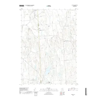
2019 Map of Victory
USGS Topo · Published 2019About this map
Red Creek and the surrounding rural landscape near the border of Wayne Co and Cayuga Co are defined by a network of creeks and drumlin-like terrain. Small communities including Westbury, Victory, and Spring Lake serve as local anchors in this agricultural region. The landscape is punctuated by several burial grounds essential for genealogical research, such as Southside Cem, French Cem, and Victory Union Cem. Water is a constant presence, from the northern flow of Red Cr and Blind Sodus Cr to the southern wetlands surrounding Duck Lake and Mud Pond. Significant elevation changes are marked at Cuddeback Hill and Hogback Hill, while Paradise Airport provides a modern aviation landmark amidst the traditional farm roads and township boundaries.
Find a feature on this map
89 named features on this map. Tap any name to fly to it.
Don’t see what you’re looking for? This feature index may not catch every label — zoom into the map to look around manually.
Map Details
Editions of this 2019 Victory Map
This is the sole edition of this map. No revisions or reprints were ever made.
Other maps of this area

1900 · Oswego
USGS Topo · 1:62,500

1902 · Sodus Bay
USGS Topo · 1:62,500

1902 · Clyde
USGS Topo · 1:62,500

1902 · Weedsport
USGS Topo · 1:62,500

1943 · Montezuma
USGS Topo · 1:31,680

1943 · Cato
USGS Topo · 1:31,680

1943 · Savannah
USGS Topo · 1:31,680

1943 · Hannibal
USGS Topo · 1:31,680

1943 · Weedsport
USGS Topo · 1:31,680

1943 · Fair Haven
USGS Topo · 1:31,680