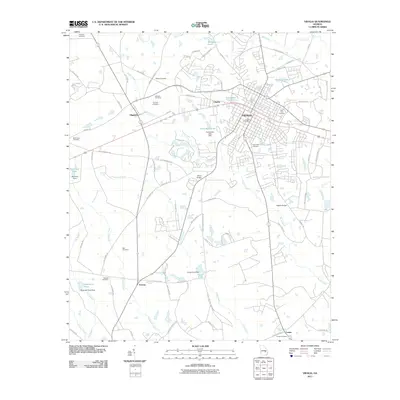
2011 Map of Vidalia
USGS Topo · Published 2011About this map
Vidalia and the surrounding Georgia countryside are mapped here during a period of steady growth along the county line. The town's grid expands around the central Vidalia Post Office, while the neighboring settlement of Higgston and the community of Charles maintain their distinct identities near the winding course of Rocky Creek. For family historians, the landscape is dotted with ancestral landmarks, including Wilson Cemetery, Kennedy Cemetery, and Johnson Cemetery to the north, and Mathias Cemetery and Bell Cemetery further south. The hydrography of the region is equally prominent, featuring a series of managed waters like McGowan Pond, Achenbach Lake, and Dejarnetts Pond. Notable crossings such as Sharp Bridge and Hughes Bridge over the local creeks link the rural farming properties and timber lands to the urban center.
Find a feature on this map
92 named features on this map. Tap any name to fly to it.
Don’t see what you’re looking for? This feature index may not catch every label — zoom into the map to look around manually.
Map Details
Editions of this 2011 Vidalia Map
This is the sole edition of this map. No revisions or reprints were ever made.
Other maps of this area

1957 · Macon
USGS Topo · 1:250,000

1958 · Macon
USGS Topo · 1:250,000

1964 · Macon
USGS Topo · 1:250,000

1970 · Johnson Corner
USGS Topo · 1:24,000

1970 · Alston
USGS Topo · 1:24,000

1970 · Oak Park SW
USGS Topo · 1:24,000

1970 · Mount Vernon
USGS Topo · 1:24,000

1970 · Vidalia
USGS Topo · 1:24,000

1970 · Uvalda
USGS Topo · 1:24,000

1970 · Lyons
USGS Topo · 1:24,000