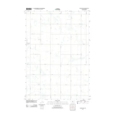
2012 Map of Vienna East
USGS Topo · Published 2012About this map
The Dixon Cem stands as a focal point for genealogical research in this prairie landscape east of Vienna, South Dakota. This 2012 survey reveals a classic Midwestern section-line grid system, where travel is dictated by gravel and paved corridors such as Co Hwy 40 and Co Hwy L. The map illustrates a high density of small, unnamed wetlands and depressions typical of the regional topography, scattered amongst the agricultural plots defined by 182nd St and 190th St. While primarily rural, the western edge near Clark Ave and Milwaukee Ave hints at the outskirts of localized development, providing a clear record of land use and road connectivity in the early twenty-first century.
Find a feature on this map
22 named features on this map. Tap any name to fly to it.
Don’t see what you’re looking for? This feature index may not catch every label — zoom into the map to look around manually.
Map Details
Editions of this 2012 Vienna East Map
This is the sole edition of this map. No revisions or reprints were ever made.
Other maps of this area

1953 · Watertown
USGS Topo · 1:250,000

1958 · Watertown
USGS Topo · 1:250,000

1973 · Bryant NE
USGS Topo · 1:24,000

1973 · Bryant
USGS Topo · 1:24,000
1973 · Gertson Slough
USGS Topo · 1:24,000

1973 · Vienna West
USGS Topo · 1:24,000
1973 · Cherry Lake
USGS Topo · 1:24,000

1973 · Naples
USGS Topo · 1:24,000
1973 · Grover
USGS Topo · 1:24,000

1973 · Vienna East
USGS Topo · 1:24,000