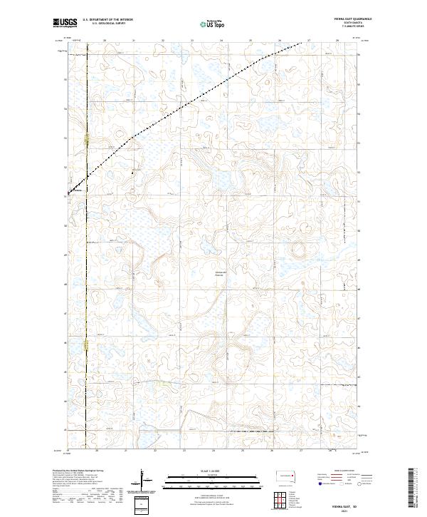
2021 Map of Vienna East
USGS Topo · Published 2021About this map
Coteau des Prairies, a vast highland plateau, dominates this part of eastern South Dakota where the high plains meet glacial drift. This landscape is characterized by its high density of small wetlands and potholes, scattered across a grid of section lines including 182nd St and 438th Ave. The settlement of Vienna sits on the western edge of the quadrangle, straddling the Clark Co Hamlin Co border. Local history is anchored by the Dixon Cem, located north of town. The area’s transport network is defined by a rigorous township-and-range system, with arterial routes like Co Rd R and Co Rd L providing the primary connectivity between farming homesteads in this sparsely populated agricultural region.
Find a feature on this map
28 named features on this map. Tap any name to fly to it.
Don’t see what you’re looking for? This feature index may not catch every label — zoom into the map to look around manually.
Map Details
Editions of this 2021 Vienna East Map
This is the sole edition of this map. No revisions or reprints were ever made.
Other maps of this area

1953 · Watertown
USGS Topo · 1:250,000

1958 · Watertown
USGS Topo · 1:250,000

1973 · Bryant NE
USGS Topo · 1:24,000

1973 · Bryant
USGS Topo · 1:24,000
1973 · Gertson Slough
USGS Topo · 1:24,000

1973 · Vienna West
USGS Topo · 1:24,000
1973 · Cherry Lake
USGS Topo · 1:24,000

1973 · Naples
USGS Topo · 1:24,000
1973 · Grover
USGS Topo · 1:24,000

1973 · Vienna East
USGS Topo · 1:24,000