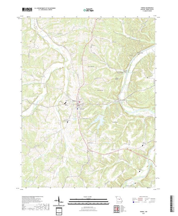
2021 Map of Vienna
USGS Topo · Published 2021About this map
Vienna serves as the focal point of this Maries County survey, anchored by the Maries County Courthouse near the junction of several regional routes. The landscape is defined by the winding course of the Gasconade River to the east and the Maries River in the northwest, creating a network of ridges and hollows like Waddle Hollow and Daggett Hollow. For those tracing local history, the map identifies several significant burial sites, including the Maries County Poor Farm Cem and the Visitation Cem. The terrain is marked by distinctive elevations such as Stencer Ridge and Woods Ridge, while Johnson Island sits at the confluence of the Gasconade and Spring Cr. Modern infrastructure like the Vienna Bridge and several state highways intersect with older features like the House Mounds, reflecting a long history of human activity in this river-rich corridor.
Find a feature on this map
63 named features on this map. Tap any name to fly to it.
Don’t see what you’re looking for? This feature index may not catch every label — zoom into the map to look around manually.
Map Details
Editions of this 2021 Vienna Map
This is the sole edition of this map. No revisions or reprints were ever made.
Other maps of this area

1888 · Tuscumbia
USGS Topo · 1:125,000

1894 · Tuscumbia
USGS Topo · 1:125,000

1934 · Linn
USGS Topo · 1:48,000

1937 · Vienna
USGS Topo · 1:62,500

1938 · Vienna
USGS Topo · 1:48,000

1942 · Linn
USGS Topo · 1:62,500

1945 · Linn
USGS Topo · 1:62,500

1947 · Jefferson City
USGS Topo · 1:250,000

1948 · Meta
USGS Topo · 1:62,500

1948 · Tavern
USGS Topo · 1:62,500